Terri and I decided to travel to Dump Coke South--the other side of the cove we were at the day before. The road to this end comes off of 8th Ave at the Seabees monument.

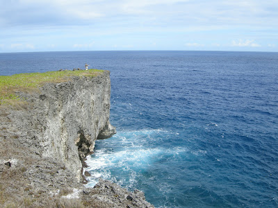
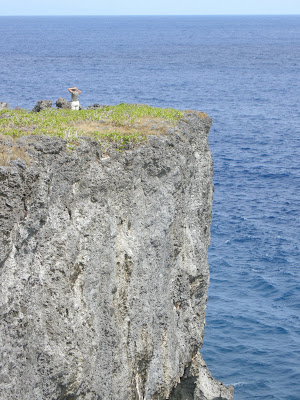
For the last couple of days men have been working on the radio towers on Tinian. This is where the Voice of America is sent to Asia. The small dot you can see between the two towers is actually a man hanging off a cable! Who is this guy? How much would they have to pay you to hang hundreds of feet in the air?

This is a small home to be found along 8th Ave

There was a small access road that ran north. We thought perhaps this was the road to Dump Coke South, but it ended up to be a dead-end--just an access road to property.

The access road is to the left, while the road we are traveling continued directly west towards the ocean.

The access road was quite a long drive, and ended up behind the communication towers we had seen before.

It was a beautiful road to nowhere!

As you can see, it simply ends in jungle

All along the road were gates to access private property. It was a beautiful area of the island!


Every now and then we would see roads going off to the side. We decided to take this road, as we could tell it was very new, and had just been made.

At the end of the road was a gate to someone's property. The access road was perhaps 1/3 of a mile long-- a lot of work cutting away the jungle just to get to your front gate!

Then we headed back west to try to get to the road that went to our destination

We finally hit another T in the road, with this road, like the access road, heading directly north. If we were to continue west, it would have taken us to Fleming Point, which we had seen before.

The road was in pretty good shape--much better than the Dump Coke North road was the day before.

The area opened up several times, and more roads took off of this one, perhaps connecting to other property as well.

The road finally turned west again towards the ocean, and began to drop down--though not as steeply as the north road had done. It was much easier to get out of this area on the way back also.

The trail closed in for the first time in this area, but it was still easy to ride through it

You can see Terri ahead of me as the road descends towards the shoreline

If you look closely, you can see Terri to the left as she continues out to the clearing at the point, which is to the right.

The cliff line could be seen directly to our right, dropping off about 100' to a small beach below

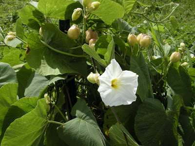
Even on the sides of steep cliffs you can find amazing flowers!

This is the view to our right as we begin to follow the cliff line to the end


This is looking back from the west end of this south point of the cove

You can see Terri standing at the end of the peninsula, and the sheer drop into the ocean!


It is a great place to come for some peace and quiet, and to ponder the meaning of life...

Here is the view looking North, towards the point where we visited yesterday

And this is looking south toward Fleming Point. There were two small fishing boats that we could see. You can also get a feel for what it is like to walk around in this area--very rough volcanic rock. Ankle-busters I think they are called!

Here we are, at the south end of the cove, ready for the climb back up the hill
How is it that I can walk 3-6 miles a day, and Terri is the one that looks good? Life just isn't fair!

Found some odd looking plants on this trip!
 Even on the sides of steep cliffs you can find amazing flowers!
 This is the view to our right as we begin to follow the cliff line to the end
 This is looking back from the west end of this south point of the cove
 You can see Terri standing at the end of the peninsula, and the sheer drop into the ocean!
 It is a great place to come for some peace and quiet, and to ponder the meaning of life...
 Here is the view looking North, towards the point where we visited yesterday
 And this is looking south toward Fleming Point. There were two small fishing boats that we could see. You can also get a feel for what it is like to walk around in this area--very rough volcanic rock. Ankle-busters I think they are called!


1 comment:
Envy. Hope it isn't a sin. All the same, thanks for a picture in time.
Post a Comment